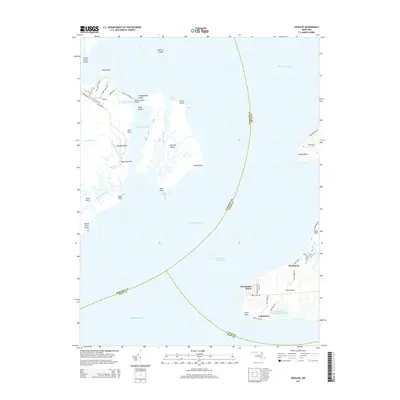
2014 Map of Spesutie
USGS Topo · Published 2014About this map
Spesutie Island and the surrounding upper Chesapeake Bay define this coastal landscape, where Harford, Cecil, and Kent counties meet in the water. The island itself is marked by distinctive points like Woodpecker Point and Mulberry Point, separated from the mainland by the Spesutie Narrows. On the eastern shore in Cecil County, residential developments such as Chesapeake Haven, Cheshaven, and Hazelmoor sit atop Grove Neck, overlooking the bay and the Intracoastal Waterway. The presence of the Grove Point Disposal Area Lake and various marshy inlets like Mosquito Creek and Back Creek indicates a complex shoreline managed for both environmental preservation and maritime transit. Small settlements like Spesutie provide land-side context near the Spesutie Island Bridge, reflecting the region's long-standing connection to the Chesapeake's tidal reaches.
Find a feature on this map
57 named features on this map. Tap any name to fly to it.
Don’t see what you’re looking for? This feature index may not catch every label — zoom into the map to look around manually.
Map Details
Editions of this 2014 Spesutie Map
This is the sole edition of this map. No revisions or reprints were ever made.
Other maps of this area

1898 · Elkton
USGS Topo · 1:62,500

1898 · Tolchester
USGS Topo · 1:125,000

1899 · Dover
USGS Topo · 1:125,000

1900 · Elkton
USGS Topo · 1:62,500

1900 · Cecilton
USGS Topo · 1:62,500

1900 · Havre De Grace
USGS Topo · 1:62,500

1900 · Betterton
USGS Topo · 1:62,500

1903 · Tolchester
USGS Topo · 1:125,000

1906 · Dover
USGS Topo · 1:125,000

1908 · Tolchester
USGS Topo · 1:125,000