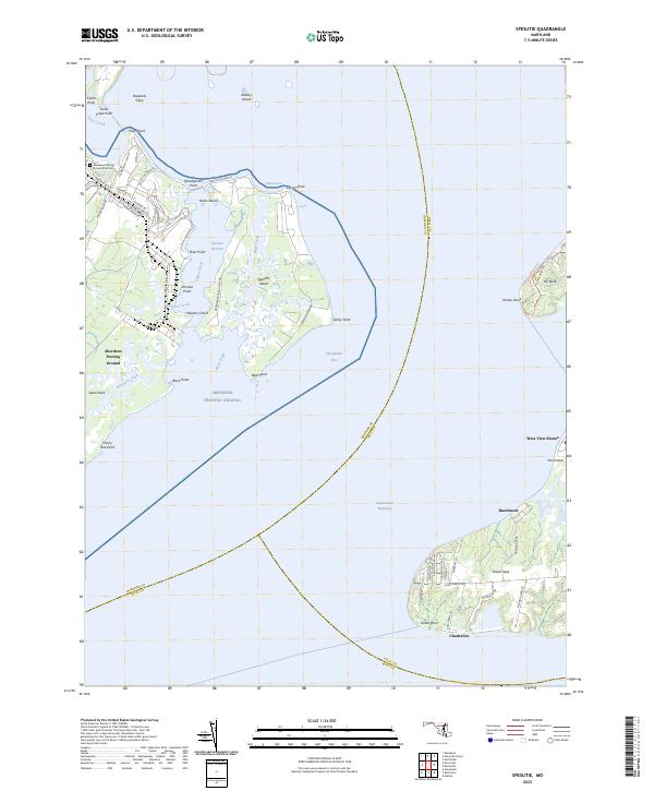
2023 Map of Spesutie
USGS Topo · Published 2023About this map
The Aberdeen Proving Ground dominates the western portion of this 2023 survey, detailing the military installation’s extensive road network and specialized sites such as Bomb Proof Rd and the Aberdeen Proving Ground Post Cem. The landscape is defined by the complex waterways where Swan Creek meets the Chesapeake Bay, surrounding the expansive Spesutie Island. Across the water, the eastern shoreline of the Intracoastal Waterway features the developed communities of West View Shores and Hazelmoor. This map provides a detailed view of the modern coastal geography of Harford and Cecil Counties, including distinctive landmarks like the Turkey Point Lighthouse Tri at Elk Neck and the named shoals and points like Buzzards Glory and Cherry Tree Point that have shaped maritime navigation for generations.
Find a feature on this map
65 named features on this map. Tap any name to fly to it.
Don’t see what you’re looking for? This feature index may not catch every label — zoom into the map to look around manually.
Map Details
Editions of this 2023 Spesutie Map
This is the sole edition of this map. No revisions or reprints were ever made.
Other maps of this area

1898 · Elkton
USGS Topo · 1:62,500

1898 · Tolchester
USGS Topo · 1:125,000

1899 · Dover
USGS Topo · 1:125,000

1900 · Elkton
USGS Topo · 1:62,500

1900 · Cecilton
USGS Topo · 1:62,500

1900 · Havre De Grace
USGS Topo · 1:62,500

1900 · Betterton
USGS Topo · 1:62,500

1903 · Tolchester
USGS Topo · 1:125,000

1906 · Dover
USGS Topo · 1:125,000

1908 · Tolchester
USGS Topo · 1:125,000