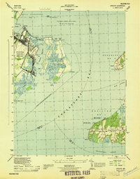
1944 Map of Spesutie
USGS Topo · Published 1944About this map
The Aberdeen Proving Ground dominates the western shoreline of this wartime coastal survey, marking a period of intense military activity along the Chesapeake Bay. To the east, Spesutie Island sits separated from the mainland by the Spesutie Narrows, featuring several named points such as Bear Pt and Sandy Pt. The map captures a landscape of transition, where established maritime landmarks like Turkey Point LH and Fishing Battery Lt guide vessels through the confluence of the Elk River and the Sassafras River. Across the water, the peninsula of Grove Neck shows a detailed network of rural infrastructure, including Grove Neck Road and multiple range lights. This 1944 edition also records an Abandoned Airport and the settlement of Woodcrest, providing a look at the military and domestic geography of Harford and Cecil Counties during the height of the 1940s.
Find a feature on this map
50 named features on this map. Tap any name to fly to it.
Don’t see what you’re looking for? This feature index may not catch every label — zoom into the map to look around manually.
Map Details
Editions of this 1944 Spesutie Map
This is the sole edition of this map. No revisions or reprints were ever made.
Other maps of this area

1898 · Elkton
USGS Topo · 1:62,500

1898 · Tolchester
USGS Topo · 1:125,000

1899 · Dover
USGS Topo · 1:125,000

1900 · Elkton
USGS Topo · 1:62,500

1900 · Cecilton
USGS Topo · 1:62,500

1900 · Havre De Grace
USGS Topo · 1:62,500

1900 · Betterton
USGS Topo · 1:62,500

1903 · Tolchester
USGS Topo · 1:125,000

1906 · Dover
USGS Topo · 1:125,000

1908 · Tolchester
USGS Topo · 1:125,000