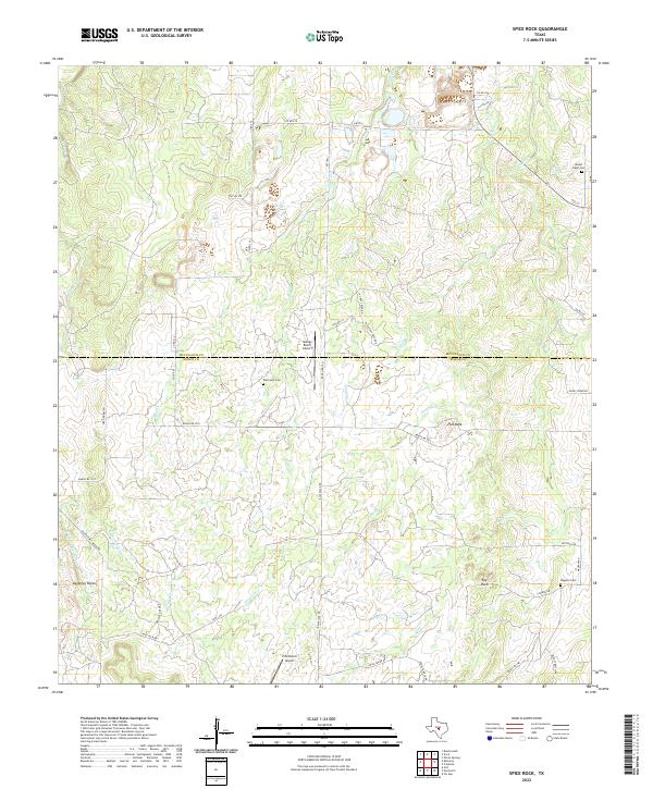
2022 Map of Spice Rock
USGS Topo · Published 2022About this map
The McCulloch Co and Mason Co border divides this ranchland landscape, where a network of unpaved roads and cattle guards connects isolated homesteads and working livestock operations. The terrain is defined by distinct geologic outcroppings and landmarks like Spy Rock, Flat Rock, and the granite formations of Katemcy Rocks. Seasonal drainage is captured by a series of creeks, including Sandy Creek and Tiger Creek, which are supplemented by features like Devils Spring. For those tracing local families, several rural burial grounds are documented across the hills, including Mount Tabor Cem, Blackjack Cem, and Wagram Cem. The presence of Harkey Ranch Airport and Polk Ranch Airport reflects the continued importance of private aviation in managing these large Texas hill country estates.
Find a feature on this map
46 named features on this map. Tap any name to fly to it.
Don’t see what you’re looking for? This feature index may not catch every label — zoom into the map to look around manually.
Map Details
Editions of this 2022 Spice Rock Map
This is the sole edition of this map. No revisions or reprints were ever made.
Other maps of this area

1887 · Mason
USGS Topo · 1:125,000

1894 · Brady
USGS Topo · 1:125,000

1894 · Mason
USGS Topo · 1:125,000

1954 · Brownwood
USGS Topo · 1:250,000

1954 · Llano
USGS Topo · 1:250,000

1955 · Llano
USGS Topo · 1:250,000

1956 · Llano
USGS Topo · 1:250,000

1962 · Purdy Hill
USGS Topo · 1:24,000
1962 · Fly Gap
USGS Topo · 1:24,000
1962 · Fredonia
USGS Topo · 1:24,000