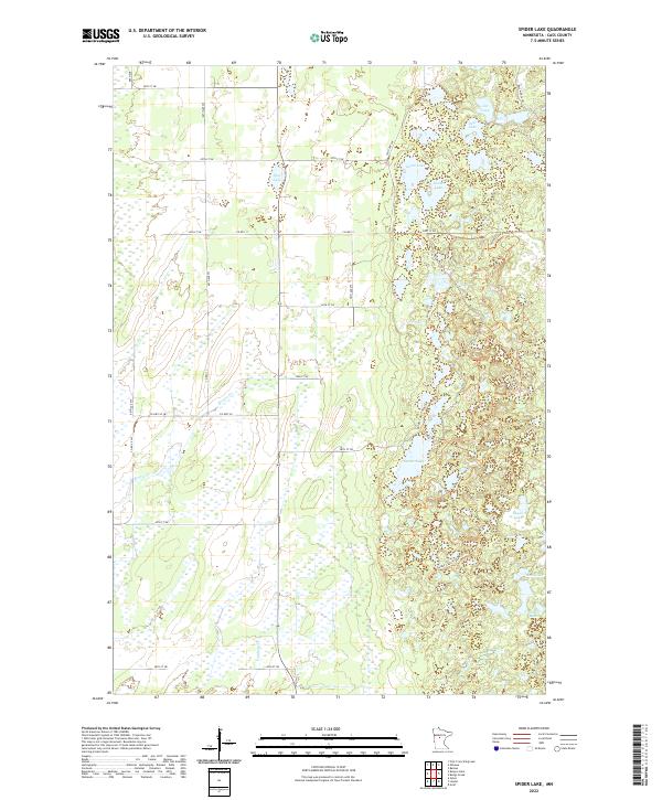
2022 Map of Spider Lake
USGS Topo · Published 2022About this map
Spider Lake and its surrounding wetlands dominate this 2022 survey of Cass County, Minnesota. The landscape is defined by an intricate network of water bodies, including Goose Lake, Clear Lake, and the smaller Mink Lake and Crane Lake. The terrain exhibits a high concentration of marshy lowlands drained by watercourses such as Beaver Cr and Farnham Cr. Human activity in the area is largely characterized by outdoor recreation and forest management, evidenced by the extensive Spider Lake Trails Trl that winds through the eastern half of the map. Road access is provided by a grid of county routes like CO Hwy 2 and Co Rd 111, which navigate between the numerous kettle lakes and wetland depressions typical of this glacial region.
Find a feature on this map
31 named features on this map. Tap any name to fly to it.
Don’t see what you’re looking for? This feature index may not catch every label — zoom into the map to look around manually.
Map Details
Editions of this 2022 Spider Lake Map
This is the sole edition of this map. No revisions or reprints were ever made.
Other maps of this area

1919 · Leader
USGS Topo · 1:62,500

1953 · Brainerd
USGS Topo · 1:250,000

1957 · Brainerd
USGS Topo · 1:250,000

1958 · Brainerd
USGS Topo · 1:250,000

1965 · Brainerd
USGS Topo · 1:250,000

1969 · Burgen Lake
USGS Topo · 1:24,000
1969 · Oylen
USGS Topo · 1:24,000

1970 · Spider Lake
USGS Topo · 1:24,000

1970 · Backus
USGS Topo · 1:24,000
1970 · Bungo Creek
USGS Topo · 1:24,000