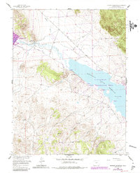
1956 Map of Spinney Mountain
USGS Topo · Published 1985About this map
The South Platte River winds through this high-altitude landscape, feeding into the massive Elevenmile Canyon Reservoir and the smaller Spinney Mountain Reservoir. This mid-century survey, with revisions from the 1980s, documents a transition from traditional ranching lands to recreational water management. The prominent presence of the Hartsel Ranch (Lower Spinney Unit) and Hartsel Ranch (Rogers Unit) highlights the area's agricultural roots, while the Elevenmile Canyon State Recreation Area points toward its modern utility. Transportation history is visible in the Old Railroad Grade that skirts the riverbank, and the Aqueduct near the southern boundary reveals the complex engineering required to manage mountain water resources. The terrain is framed by high points like Stoll Mountain and Spinney Mtn, with much of the eastern and southern portions falling within the Pike National Forest.
Find a feature on this map
25 named features on this map. Tap any name to fly to it.
Don’t see what you’re looking for? This feature index may not catch every label — zoom into the map to look around manually.
Map Details
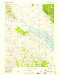
Editions of this 1956 Spinney Mountain Map
3 editions found

Other maps of this area

1893 · Platte Canyon
USGS Topo · 1:125,000

1894 · Pikes Peak
USGS Topo · 1:125,000

1901 · Pikes Peak
USGS Topo · 1:125,000

1953 · Denver
USGS Topo · 1:250,000

1954 · Pueblo
USGS Topo · 1:250,000

1956 · Tarryall
USGS Topo · 1:24,000

1956 · Sulphur Mountain
USGS Topo · 1:24,000

1956 · Elevenmile Canyon
USGS Topo · 1:24,000

1956 · Guffey NW
USGS Topo · 1:24,000

1956 · Glentivar
USGS Topo · 1:24,000