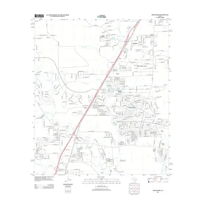
2013 Map of Splendora
USGS Topo · Published 2013About this map
Peach Creek and Caney Creek define the drainage of this East Texas landscape, where suburban expansion meets legacy extraction industries. The Splendora Oil Field occupies the central portion of the map, illustrating the continued significance of petroleum in Montgomery County's development. Organized residential pockets like Roman Forest, Patton Village, and Woodbranch show the 21st-century transition toward commuter communities, yet the map remains anchored by historical landmarks. Genealogists will find several burial grounds including Splendora Cemetery, Kid Cem, and Robinson Cem. The presence of the Houston and Harris County Camp and the Union Encampment near the East Fork San Jacinto River suggests the area's role as a regional recreational and gathering hub, while small settlements like Gabriel and Keefer mark older crossroads and rail-line stops.
Find a feature on this map
367 named features on this map. Tap any name to fly to it.
Don’t see what you’re looking for? This feature index may not catch every label — zoom into the map to look around manually.
Map Details
Editions of this 2013 Splendora Map
This is the sole edition of this map. No revisions or reprints were ever made.
Other maps of this area

1916 · Moonshine Hill
USGS Topo · 1:24,000

1916 · Huffman
USGS Topo · 1:24,000

1919 · Weeden
USGS Topo · 1:31,680

1920 · Moonshine Hill
USGS Topo · 1:31,680

1920 · Huffman
USGS Topo · 1:31,680

1954 · Beaumont
USGS Topo · 1:250,000

1957 · Beaumont
USGS Topo · 1:250,000

1958 · Fostoria
USGS Topo · 1:24,000

1958 · Cleveland
USGS Topo · 1:24,000

1959 · Plum Grove
USGS Topo · 1:24,000