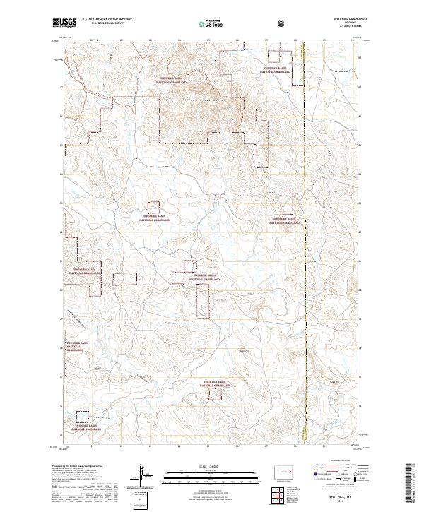
2021 Map of Split Hill
USGS Topo · Published 2021About this map
Thunder Basin National Grassland dominates this high-plains landscape in Wyoming, where a complex network of draws and ephemeral creeks defines the eastern drainage patterns of the Powder River Basin. The terrain is punctuated by significant landmarks like the Cow Creek Buttes, which are accessible via a dedicated trail system including the Cow Creek Buttes Trl and its western and southern counterparts. The map records the early 21st-century character of this open range, where natural features like Split Hill and Cake Hill rise above the surrounding Downs Country.
Find a feature on this map
33 named features on this map. Tap any name to fly to it.
Don’t see what you’re looking for? This feature index may not catch every label — zoom into the map to look around manually.
Map Details
Editions of this 2021 Split Hill Map
This is the sole edition of this map. No revisions or reprints were ever made.
Other maps of this area

1955 · Newcastle
USGS Topo · 1:250,000

1958 · Newcastle
USGS Topo · 1:250,000

1970 · Bill 4 SE
USGS Topo · 1:24,000

1970 · Bill 4 NE
USGS Topo · 1:24,000

1971 · Esau Spring
USGS Topo · 1:24,000

1979 · Bill
USGS Topo · 1:100,000

1981 · Calf Draw
USGS Topo · 1:24,000

1981 · Mercer Draw
USGS Topo · 1:24,000

1981 · Pinnacle Rocks
USGS Topo · 1:24,000
1981 · Split Hill SW
USGS Topo · 1:24,000