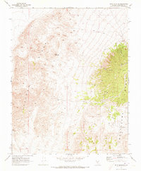
1970 Map of Split Mountain
USGS Topo · Published 1973About this map
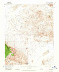
Split Mountain dominates this portion of Esmeralda County, standing between the distinct geological formations of Clayton Ridge and the Montezuma Range. The landscape is defined by its arid, high-elevation character, where infrastructure is sparse and tied primarily to historical resource extraction and modern communications. Evidence of past activity is found near Nevada Canyon, which contains both Ruins and an unspecified Mine site.
Find a feature on this map
12 named features on this map. Tap any name to fly to it.
Don’t see what you’re looking for? This feature index may not catch every label — zoom into the map to look around manually.
Map Details
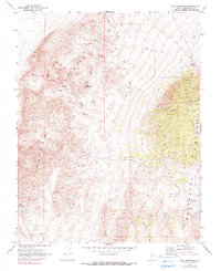
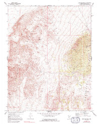
Editions of this 1970 Split Mountain Map
3 editions found
Other maps of this area

1898 · Silver Peak
USGS Topo · 1:125,000

1900 · Silver Peak
USGS Topo · 1:125,000

1908 · Lida
USGS Topo · 1:250,000

1913 · Lida
USGS Topo · 1:250,000
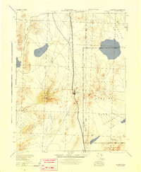
1945 · Goldfield
USGS Topo · 1:125,000

1954 · Goldfield
USGS Topo · 1:250,000

1955 · Goldfield
USGS Topo · 1:250,000

1958 · Goldfield
USGS Topo · 1:250,000

1962 · Goldfield
USGS Topo · 1:250,000
1963 · Silver Peak
USGS Topo · 1:62,500