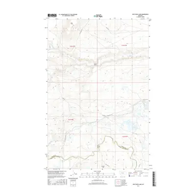
2017 Map of Split Rock Lake
USGS Topo · Published 2017About this map
Split Rock Lake and the engineered waterways of the Pishkun Canal dominate this landscape along the border of Teton and Lewis and Clark Counties. The terrain is defined by dramatic elevation changes, notably the Black Reef and Long Ridge in the northern reaches, where the N Fork Deep Cr and S Fork Deep Cr emerge. The presence of the Pishkun Reservoir and Tunnel Lake reflects the region's managed water resources, while the Sun River winds through the southern portion of the quadrangle. Significant coulees, such as Arnold Coulee and Oxheart Coulee, cut through the plains, offering a detailed look at the drainage patterns and landforms that shaped local ranching and travel routes like Pishkin Rd.
Find a feature on this map
22 named features on this map. Tap any name to fly to it.
Don’t see what you’re looking for? This feature index may not catch every label — zoom into the map to look around manually.
Map Details
Editions of this 2017 Split Rock Lake Map
This is the sole edition of this map. No revisions or reprints were ever made.
Other maps of this area

1903 · Saypo
USGS Topo · 1:125,000

1920 · Choteau
USGS Topo · 1:125,000

1955 · Choteau
USGS Topo · 1:250,000

1957 · Choteau
USGS Topo · 1:250,000

1958 · Choteau
USGS Topo · 1:250,000

1958 · Ear Mountain
USGS Topo · 1:24,000

1958 · Lake Theboe
USGS Topo · 1:24,000

1958 · Barr Creek
USGS Topo · 1:24,000

1958 · Sawtooth Ridge
USGS Topo · 1:24,000

1958 · Castle Reef
USGS Topo · 1:24,000