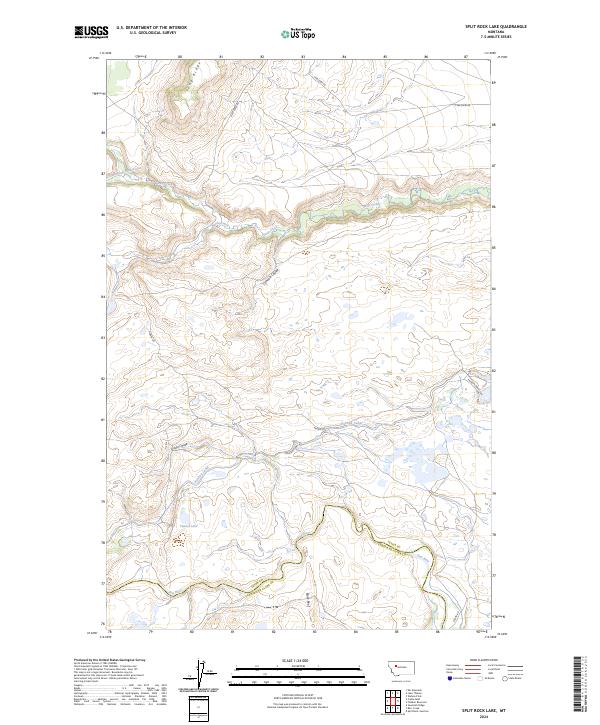
2024 Map of Split Rock Lake
USGS Topo · Published 2024About this map
Blackfoot Valley Conservation Area land spans a complex topography of ridges and coulees where the high plains meet the Rocky Mountain Front. The Sun River snakes across the southern portion of the sheet, marking the county line between Teton and Lewis and Clark Counties. This landscape is defined by the elaborate water management infrastructure of the Pishkun Canal, which traverses the center of the quadrangle to feed regional reservoirs. Historically significant terrain features like Long Ridge, Black Reef, and Arnold Coulee provide landmarks for those tracing the traditional ranching and irrigation patterns of north-central Montana. The presence of Tunnel Lake and various coulees highlights a geography shaped by both natural erosion and intentional water diversion for agricultural use.
Find a feature on this map
21 named features on this map. Tap any name to fly to it.
Don’t see what you’re looking for? This feature index may not catch every label — zoom into the map to look around manually.
Map Details
Editions of this 2024 Split Rock Lake Map
This is the sole edition of this map. No revisions or reprints were ever made.
Other maps of this area

1903 · Saypo
USGS Topo · 1:125,000

1920 · Choteau
USGS Topo · 1:125,000

1955 · Choteau
USGS Topo · 1:250,000

1957 · Choteau
USGS Topo · 1:250,000

1958 · Choteau
USGS Topo · 1:250,000

1958 · Ear Mountain
USGS Topo · 1:24,000

1958 · Lake Theboe
USGS Topo · 1:24,000

1958 · Barr Creek
USGS Topo · 1:24,000

1958 · Sawtooth Ridge
USGS Topo · 1:24,000

1958 · Castle Reef
USGS Topo · 1:24,000