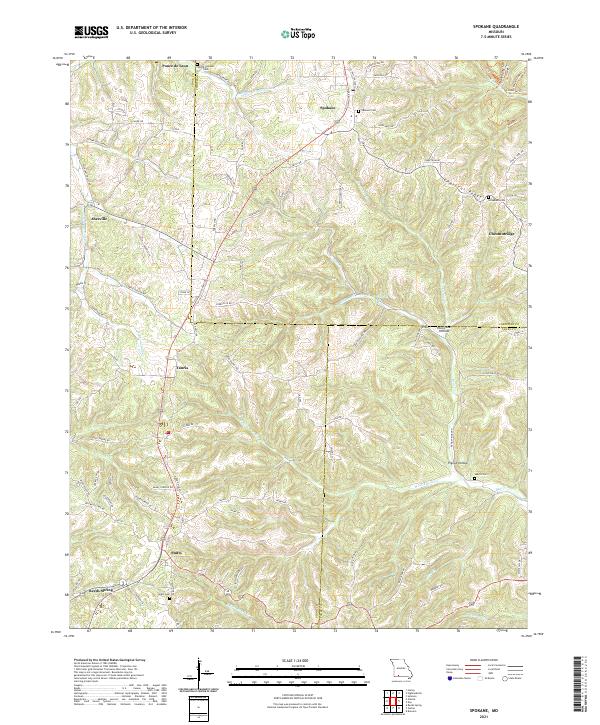
2021 Map of Spokane
USGS Topo · Published 2021About this map
Ponce de Leon and Spokane anchor this map of the Ozark plateau, illustrating a landscape defined by deep hollows and narrow ridges. The settlement pattern follows the high ground of Chestnut Ridge and the winding road networks like Reno Springs Rd and Jonesville Rd. Local history is preserved through numerous family and community burial grounds, including the Schupbach Cem near Chestnutridge and the Seaton Cem overlooking Pignut Hollow.
Find a feature on this map
69 named features on this map. Tap any name to fly to it.
Don’t see what you’re looking for? This feature index may not catch every label — zoom into the map to look around manually.
Map Details
Editions of this 2021 Spokane Map
This is the sole edition of this map. No revisions or reprints were ever made.
Other maps of this area

1907 · Forsyth
USGS Topo · 1:125,000

1945 · Harrison
USGS Topo · 1:250,000

1949 · Harrison
USGS Topo · 1:250,000

1950 · Garber
USGS Topo · 1:24,000

1954 · Harrison
USGS Topo · 1:250,000
1955 · Selmore
USGS Topo · 1:24,000

1955 · Day
USGS Topo · 1:24,000
1955 · Hurley
USGS Topo · 1:24,000
1955 · Highlandville
USGS Topo · 1:24,000

1956 · Garber
USGS Topo · 1:24,000