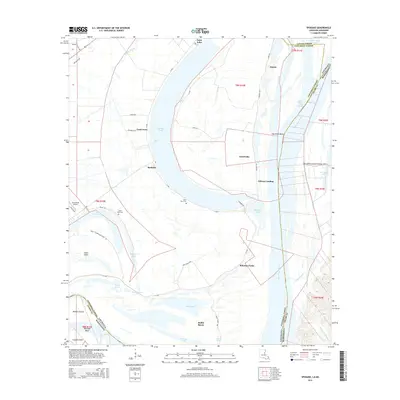
2015 Map of Spokane
USGS Topo · Published 2015About this map
Gibson Landing and the riverfront communities of Concordia Parish define this section of the Mississippi River floodplain in the mid-2010s. The landscape is shaped by massive water bodies like the oxbow Lake Saint John and the crescent of Lake Concordia, while the river's dynamic history is written in the names of the Waterproof Cutoff and Fairchilds Bend. These waterways dictate the placement of local settlements such as Canebrake, Spokane, and Argent, which are linked by state routes like La-568. For those researching local heritage, the map identifies small rural landmarks including Saint Mary Cem and Saint Paul Cem. The area also features the Summerell Airport and industrial sites like Brandenburg Pit, illustrating the blend of agricultural and utility land use along the Louisiana-Mississippi border.
Find a feature on this map
58 named features on this map. Tap any name to fly to it.
Don’t see what you’re looking for? This feature index may not catch every label — zoom into the map to look around manually.
Map Details
Editions of this 2015 Spokane Map
This is the sole edition of this map. No revisions or reprints were ever made.
Other maps of this area

1909 · Sycamore Landing
USGS Topo · 1:24,000

1909 · Vidalia
USGS Topo · 1:24,000

1921 · Natchez
USGS Topo · 1:48,000

1922 · Natchez
USGS Topo · 1:62,500

1939 · Red Gum
USGS Topo · 1:62,500

1939 · Natchez
USGS Topo · 1:62,500

1939 · Locust Ridge
USGS Topo · 1:62,500

1941 · Sicily Island
USGS Topo · 1:62,500

1953 · Natchez
USGS Topo · 1:250,000

1956 · Natchez
USGS Topo · 1:250,000