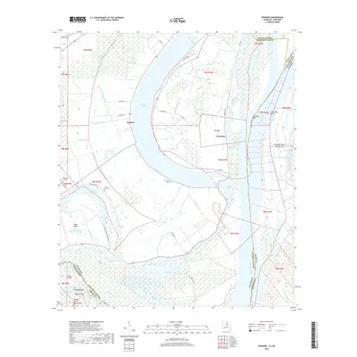
2018 Map of Spokane
USGS Topo · Published 2018About this map
Lake Saint John and Lake Concordia dominate this landscape, their crescent shapes tracing the ancient migration of the Mississippi River. Located at the boundary of Concordia Parish and Adams Co, the region is characterized by a network of bayous and low-lying wetlands, including Bullitt Bayou and Grassy Lake. Small settlements like Spokane and Canebrake are situated on the higher ground of former river bends.
Find a feature on this map
50 named features on this map. Tap any name to fly to it.
Don’t see what you’re looking for? This feature index may not catch every label — zoom into the map to look around manually.
Map Details
Editions of this 2018 Spokane Map
This is the sole edition of this map. No revisions or reprints were ever made.
Other maps of this area

1909 · Sycamore Landing
USGS Topo · 1:24,000

1909 · Vidalia
USGS Topo · 1:24,000

1921 · Natchez
USGS Topo · 1:48,000

1922 · Natchez
USGS Topo · 1:62,500

1939 · Red Gum
USGS Topo · 1:62,500

1939 · Natchez
USGS Topo · 1:62,500

1939 · Locust Ridge
USGS Topo · 1:62,500

1941 · Sicily Island
USGS Topo · 1:62,500

1953 · Natchez
USGS Topo · 1:250,000

1956 · Natchez
USGS Topo · 1:250,000