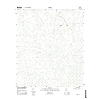
2017 Map of Spooner
USGS Topo · Published 2017About this map
Jamestown and Spooner anchor this rural landscape in the 2010s, situated on the border of Ware and Clinch counties. The terrain is defined by a dense network of blackwater drainages including Surveyors Cr, Turkey Br, and Cane Cr, which flow through the forested wetlands. The influence of the massive Okefenokee Swamp is felt in the southeastern portion of the map, where the environment shifts into the vast, low-lying marshes of Stevens Bay. Local navigation depends on a grid of rural routes such as Antioch Church Rd and Hinson Rd, while smaller landmarks like Gainey Island and Pittmans Pond offer specific points of interest for those studying the hydrology and land-use patterns of this specific corner of South Georgia.
Find a feature on this map
27 named features on this map. Tap any name to fly to it.
Don’t see what you’re looking for? This feature index may not catch every label — zoom into the map to look around manually.
Map Details
Editions of this 2017 Spooner Map
This is the sole edition of this map. No revisions or reprints were ever made.
Other maps of this area

1953 · Waycross
USGS Topo · 1:250,000

1954 · Valdosta
USGS Topo · 1:250,000

1958 · Valdosta
USGS Topo · 1:250,000

1958 · Waycross
USGS Topo · 1:250,000

1959 · Valdosta
USGS Topo · 1:250,000

1966 · The Pocket
USGS Topo · 1:24,000

1966 · Cravens Island
USGS Topo · 1:24,000

1967 · Spooner
USGS Topo · 1:24,000

1967 · Colon
USGS Topo · 1:24,000

1967 · Waycross SW
USGS Topo · 1:24,000