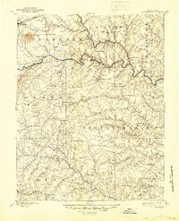
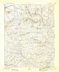
1892 Map of Spotsylvania
USGS Topo · Published 1944About this map
The Rappahannock River carves a winding path through this late 19th-century landscape, separating the rolling terrain of Culpeper and Fauquier from the dense woods of Spotsylvania. This period was characterized by a transition from traditional agriculture to specialized industry, evidenced by the Potomac Fredericksburg and Piedmont Narrow Gauge Railroad cutting east-to-west across the central plains.
Find a feature on this map
94 named features on this map. Tap any name to fly to it.
Don’t see what you’re looking for? This feature index may not catch every label — zoom into the map to look around manually.
Map Details
Editions of this 1892 Spotsylvania Map
6 editions found
Other maps of this area

1887 · Spottsylvania
USGS Topo · 1:125,000

1889 · Fredericksburg
USGS Topo · 1:125,000

1890 · Goochland
USGS Topo · 1:125,000

1890 · Mt. Vernon
USGS Topo · 1:125,000

1891 · Palmyra
USGS Topo · 1:125,000

1891 · Mt. Vernon
USGS Topo · 1:125,000

1892 · Fredericksburg
USGS Topo · 1:125,000

1892 · Spottsylvania
USGS Topo · 1:125,000

1892 · Goochland
USGS Topo · 1:125,000

1892 · Gordonsville
USGS Topo · 1:125,000