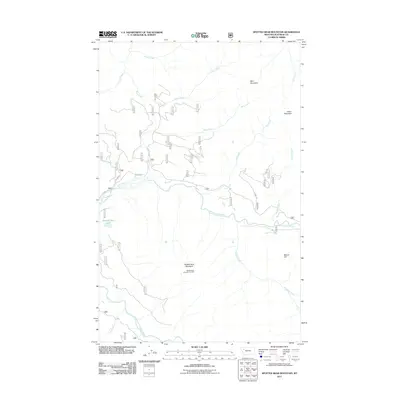
2011 Map of Spotted Bear Mountain
USGS Topo · Published 2011About this map
Spotted Bear Mountain Lookout stands as the primary vantage point over this wilderness drainage in Flathead County, overlooking the confluence where the Spotted Bear River meets the South Fork Flathead River. This 2011 survey details a landscape defined by its complex hydrology, with numerous named tributaries such as Nanny Creek, Twin Creek, and Jungle Creek feeding the larger river systems. Forest Service routes, including F S 568 RD, provide limited access through the mountain passes and along the river banks. The area's topography is anchored by prominent peaks like Bent Mountain, Green Mountain, and Spotted Bear Mountain. Near the river's bend, Spotted Bear Lake and the nearby Beaver Hill mark the transition from the high peaks to the valley floor, illustrating a terrain focused on water management and fire observation in a remote corner of Montana.
Find a feature on this map
20 named features on this map. Tap any name to fly to it.
Don’t see what you’re looking for? This feature index may not catch every label — zoom into the map to look around manually.
Map Details
Editions of this 2011 Spotted Bear Mountain Map
This is the sole edition of this map. No revisions or reprints were ever made.
Other maps of this area

1913 · Marias Pass
USGS Topo · 1:125,000

1914 · Nyack
USGS Topo · 1:125,000

1936 · Silvertip
USGS Topo · 1:96,000

1942 · Silvertip
USGS Topo · 1:125,000

1955 · Choteau
USGS Topo · 1:250,000

1957 · Choteau
USGS Topo · 1:250,000

1958 · Choteau
USGS Topo · 1:250,000

1958 · Capitol Mountain
USGS Topo · 1:24,000

1958 · Circus Peak
USGS Topo · 1:24,000

1958 · Horseshoe Peak
USGS Topo · 1:24,000