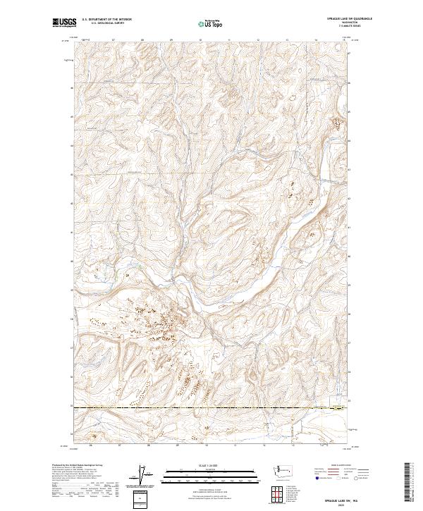
2023 Map of Sprague Lake SW
USGS Topo · Published 2023About this map
Crab Creek and its South Fork Crab Creek meander through this section of the Inland Empire, defining a landscape marked by the transition across the Lincoln and Adams County line. The terrain is structured by a grid of rural routes that likely follow early land claims and homestead boundaries, such as Doerschlag Rd E, Bourne Rd, and Soden Rd N. This region, documented in the 2020s, reflects the enduring agricultural character of Eastern Washington. The concentration of named roads like Everhart Rd and Stromberger Rd N suggests a history of family-owned farmsteads and local transit between isolated agricultural hubs. These drainage patterns and road networks illustrate how water and topography have dictated movement and settlement in this semi-arid plateau long after the initial pioneer era.
Find a feature on this map
26 named features on this map. Tap any name to fly to it.
Don’t see what you’re looking for? This feature index may not catch every label — zoom into the map to look around manually.
Map Details
Editions of this 2023 Sprague Lake SW Map
This is the sole edition of this map. No revisions or reprints were ever made.
Other maps of this area

1953 · Ritzville
USGS Topo · 1:250,000

1959 · Ritzville
USGS Topo · 1:250,000

1964 · Karakul Hills
USGS Topo · 1:24,000

1964 · Palm Lake
USGS Topo · 1:24,000

1965 · Ritzville
USGS Topo · 1:250,000

1967 · Ritzville NE
USGS Topo · 1:24,000

1969 · Harrington
USGS Topo · 1:24,000

1969 · Sprague Lake
USGS Topo · 1:24,000

1969 · Lords Valley
USGS Topo · 1:24,000
1969 · Sprague Lake SW
USGS Topo · 1:24,000