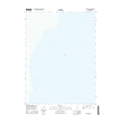
2017 Map of Spring Bay SW
USGS Topo · Published 2017About this map
Great Salt Lake dominates this 2017 survey of the Spring Bay SW quadrangle, capturing a landscape almost entirely defined by the brine waters of the northern basin. The map identifies the transition from the open lake to Spring Bay at the top of the sheet, an area characterized by its shallow, fluctuating margins. Unlike many topographic sheets, this particular map is notable for its absence of contour lines, emphasizing the extreme flatness of the salt flats and the lake bed. The lack of roads, structures, or developed infrastructure in this portion of Box Elder County highlights the environment's resistance to permanent settlement. This survey serves as a clean record of the lake's footprint and the coastal geometry of this specific northwestern Utah pocket during the mid-2010s.
Find a feature on this map
2 named features on this map. Tap any name to fly to it.
Don’t see what you’re looking for? This feature index may not catch every label — zoom into the map to look around manually.
Map Details
Editions of this 2017 Spring Bay SW Map
This is the sole edition of this map. No revisions or reprints were ever made.
Other maps of this area

1954 · Brigham City
USGS Topo · 1:250,000

1958 · Brigham City
USGS Topo · 1:250,000

1962 · Brigham City
USGS Topo · 1:250,000

1968 · Monument Point
USGS Topo · 1:24,000

1968 · Coyote Point
USGS Topo · 1:24,000

1969 · Spring Bay SW
USGS Topo · 1:24,000

1969 · Dolphin Island West
USGS Topo · 1:24,000
1969 · Gunnison Island NE
USGS Topo · 1:24,000

1969 · Locomotive Springs
USGS Topo · 1:24,000
1969 · Dolphin Island East
USGS Topo · 1:24,000