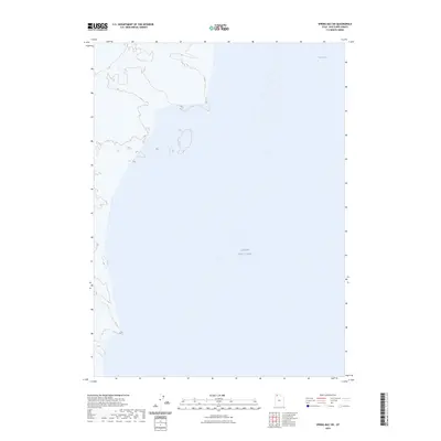
2023 Map of Spring Bay SW
USGS Topo · Published 2023About this map
Great Salt Lake dominates this 2023 survey of the remote waters of Box Elder County, Utah. The map focuses almost entirely on the aquatic landscape, featuring the expansive Great Salt Lake and the northern inlet known as Spring Bay. This is a terrain of subtle shifts in shoreline and water levels rather than human settlement, providing a precise contemporary baseline for the region's hydrography. The absence of roads, buildings, or traditional landmarks highlights the specialized nature of this quadrant, which serves as a vital record for environmental study and the shifting boundaries of Utah's most famous saline lake.
Find a feature on this map
2 named features on this map. Tap any name to fly to it.
Don’t see what you’re looking for? This feature index may not catch every label — zoom into the map to look around manually.
Map Details
Editions of this 2023 Spring Bay SW Map
This is the sole edition of this map. No revisions or reprints were ever made.
Other maps of this area

1954 · Brigham City
USGS Topo · 1:250,000

1958 · Brigham City
USGS Topo · 1:250,000

1962 · Brigham City
USGS Topo · 1:250,000

1968 · Monument Point
USGS Topo · 1:24,000

1968 · Coyote Point
USGS Topo · 1:24,000

1969 · Spring Bay SW
USGS Topo · 1:24,000

1969 · Dolphin Island West
USGS Topo · 1:24,000
1969 · Gunnison Island NE
USGS Topo · 1:24,000

1969 · Locomotive Springs
USGS Topo · 1:24,000
1969 · Dolphin Island East
USGS Topo · 1:24,000