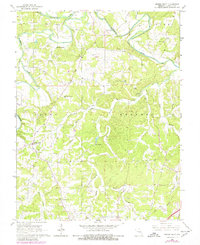
1966 Map of Spring Bluff
USGS Topo · Published 1980About this map
The Bourbeuse River carves a winding path through the northern reaches of this mid-1960s landscape, defining the topography where the townships of Boone, Meramec, and Union converge. In the community of Spring Bluff, the presence of School No 10 and several rural churches suggests a well-established, tight-knit agricultural society. The map reveals an economy tied to the earth, from the industrial activity at the Rueppele Mine and a Claypit to the various gravel pits scattered near the riverbanks.
Find a feature on this map
25 named features on this map. Tap any name to fly to it.
Don’t see what you’re looking for? This feature index may not catch every label — zoom into the map to look around manually.
Map Details
Editions of this 1966 Spring Bluff Map
3 editions found
Other maps of this area

1903 · Sullivan
USGS Topo · 1:125,000

1934 · Meramec State Park
USGS Topo · 1:24,000

1935 · Gerald
USGS Topo · 1:48,000

1937 · Meramec State Park
USGS Topo · 1:24,000

1941 · Gerald
USGS Topo · 1:62,500

1944 · Gerald
USGS Topo · 1:62,500

1946 · Union
USGS Topo · 1:62,500

1947 · Sullivan
USGS Topo · 1:62,500

1948 · Argo
USGS Topo · 1:24,000

1948 · Union
USGS Topo · 1:62,500