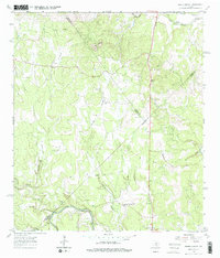
1964 Map of Spring Branch
USGS Topo · Published 1979About this map
The Guadalupe River carves the southern boundary of this Texas landscape, where the settlements of Spring Branch and Knibbe were established in the mid-1960s. This territory spans the intersection of Comal, Blanco, and Kendall counties, characterized by a dense network of seasonal drainages including Krause Creek, Simmons Creek, and Rebecca Creek. Near the northern border, the Little Blanco River flows through a region dominated by the distinctive peaks of the Twin Sisters. The presence of the Spring Branch PO, St Mary Ch, and a private Landing Strip reveals the community structure of this Hill Country pocket before significant modern suburban expansion. Local families and historians can trace old homesteads near the various Cem markers and Gravel Pit operations that dotted the rural terrain.
Find a feature on this map
26 named features on this map. Tap any name to fly to it.
Don’t see what you’re looking for? This feature index may not catch every label — zoom into the map to look around manually.
Map Details
Editions of this 1964 Spring Branch Map
2 editions found

Other maps of this area

1887 · Blanco
USGS Topo · 1:125,000

1894 · Fredericksburg
USGS Topo · 1:125,000

1894 · Blanco
USGS Topo · 1:125,000

1920 · Smithsons Valley
USGS Topo · 1:62,500

1925 · Smithson Valley No. 1
USGS Topo · 1:48,000

1927 · Smithson Valley
USGS Topo · 1:62,500

1929 · Smithson Valley
USGS Topo · 1:62,500

1940 · Smithson Valley
USGS Topo · 1:62,500

1954 · Llano
USGS Topo · 1:250,000

1954 · San Antonio
USGS Topo · 1:250,000