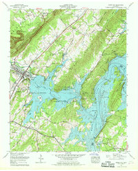
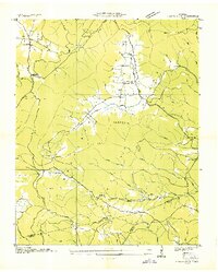
1966 Map of Spring City
USGS Topo · Published 1968About this map
Watts Bar Lake and the winding Tennessee River dominate this mid-century landscape, illustrating the profound topographical changes following the completion of the Tennessee Valley Authority dam projects. The map shows the intricate shoreline of the Piney River and Muddy Creek arms of the reservoir, where development like Piney Shores Estates and the Piney Point Resort emerged alongside established communities. The town of Spring City serves as a central hub, situated where the Southern Railway runs parallel to the base of the Cumberland Escarpment. Local genealogy is well-preserved through numerous small family burial grounds, including McClendon Cem and Hickey Cem, many of which sit near the shifting waterlines. The transition from the high, wooded terrain of Walden Ridge to the low-lying Meigs County Park reflects the diverse industrial and recreational utility of the river valley during the 1960s.
Find a feature on this map
63 named features on this map. Tap any name to fly to it.
Don’t see what you’re looking for? This feature index may not catch every label — zoom into the map to look around manually.
Map Details
Editions of this 1966 Spring City Map
4 editions found
Other maps of this area

1887 · Kingston
USGS Topo · 1:125,000

1891 · Kingston
USGS Topo · 1:125,000

1893 · Kingston
USGS Topo · 1:125,000

1935 · Rockwood
USGS Topo · 1:24,000

1935 · Evensville
USGS Topo · 1:24,000

1935 · Decatur
USGS Topo · 1:24,000

1935 · Pennine
USGS Topo · 1:24,000

1936 · Roddy
USGS Topo · 1:24,000

1936 · Spring City
USGS Topo · 1:24,000
1936 · Grassy Cove
USGS Topo · 1:24,000