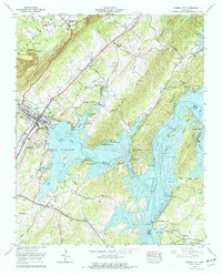
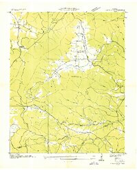
1966 Map of Spring City
USGS Topo · Published 1977About this map
Watts Bar Lake and the Tennessee River dominate the landscape of Rhea and Meigs counties, where the water flows between the Cumberland Escarpment and Walden Ridge. This mid-century view shows Spring City as a hub of the Southern Railway, its residential streets and industry tucked between the ridges. The filling of the reservoir transformed the local geography, creating Cemetery Island, Doc Smith Island, and the Dickey Bluff Peninsula from what were once high points on the riverbanks. Local history is deeply embedded in the land, with numerous family burial grounds like the Robinson Cem and Ingle Cem scattered near old settlements such as Lorraine and Grandview. The presence of the Rhea Springs Fish Hatchery and Meigs County Park reflects the area's development into a center for recreation and conservation in the decades following the construction of the Watts Bar Dam.
Find a feature on this map
96 named features on this map. Tap any name to fly to it.
Don’t see what you’re looking for? This feature index may not catch every label — zoom into the map to look around manually.
Map Details
Editions of this 1966 Spring City Map
4 editions found
Other maps of this area

1887 · Kingston
USGS Topo · 1:125,000

1891 · Kingston
USGS Topo · 1:125,000

1893 · Kingston
USGS Topo · 1:125,000

1935 · Rockwood
USGS Topo · 1:24,000

1935 · Evensville
USGS Topo · 1:24,000

1935 · Decatur
USGS Topo · 1:24,000

1935 · Pennine
USGS Topo · 1:24,000

1936 · Roddy
USGS Topo · 1:24,000

1936 · Spring City
USGS Topo · 1:24,000
1936 · Grassy Cove
USGS Topo · 1:24,000