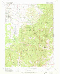
1966 Map of Spring City
USGS Topo · Published 1972About this map
Spring City sits at the base of the Wasatch Plateau, serving as a gateway to the high-elevation canyons of the Manti-La Sal National Forest. This mid-1960s survey captures the intricate irrigation infrastructure essential to Sanpete County agriculture, with numerous diversions like Mill Race Ditch, Point Ditch, and Crawford Ditch funneling water from the mountain snowpack toward the valley floor. The landscape is defined by deep drainages such as Maple Canyon and Hennings Canyon, which descend from high ridges like Hell Hole Ridge and peaks including Haystack Mtn.
Find a feature on this map
51 named features on this map. Tap any name to fly to it.
Don’t see what you’re looking for? This feature index may not catch every label — zoom into the map to look around manually.
Map Details
Editions of this 1966 Spring City Map
2 editions found
Other maps of this area

1885 · Manti
USGS Topo · 1:250,000

1895 · Manti
USGS Topo · 1:250,000

1951 · Moroni
USGS Topo · 1:62,500

1956 · Price
USGS Topo · 1:250,000

1960 · Price
USGS Topo · 1:250,000

1962 · Price
USGS Topo · 1:250,000

1965 · Huntington Reservoir
USGS Topo · 1:24,000

1966 · Spring City
USGS Topo · 1:24,000

1966 · Chester
USGS Topo · 1:24,000
1966 · Ephraim
USGS Topo · 1:24,000