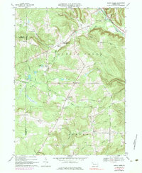
1968 Map of Spring Creek
USGS Topo · Published 1984About this map
Brokenstraw Creek winds through the northern portion of this landscape, anchoring the village of Spring Creek and its surrounding rural infrastructure. The map reveals a community defined by its watercourses and early industrial activity, including numerous oil wells scattered across the Eldred township area in the south. Local life in the late 1960s is marked by essential civic institutions such as the Spring Creek Sch, the Grange Hall, and the Spring Creek Cem. Transportation networks are dominated by the Penn Central railroad following the valley floor and several secondary roads like Tubbs Road and Whitney Road connecting upland farms. To the west, the Hemlock Lakes and various smaller runs like Brandy Run and Coldspring Creek carve through the terrain, while a dedicated Landing Strip suggests the modernization of this traditionally agricultural and resource-rich corridor.
Find a feature on this map
51 named features on this map. Tap any name to fly to it.
Don’t see what you’re looking for? This feature index may not catch every label — zoom into the map to look around manually.
Map Details
Editions of this 1968 Spring Creek Map
3 editions found
Other maps of this area

1926 · Youngsville
USGS Topo · 1:62,500

1927 · Tidioute
USGS Topo · 1:48,000

1927 · Titusville
USGS Topo · 1:62,500

1929 · Corry
USGS Topo · 1:48,000

1929 · Youngsville
USGS Topo · 1:62,500

1930 · Tidioute
USGS Topo · 1:62,500

1932 · Corry
USGS Topo · 1:62,500

1933 · Titusville
USGS Topo · 1:62,500

1943 · Youngsville
USGS Topo · 1:62,500

1957 · Warren
USGS Topo · 1:250,000