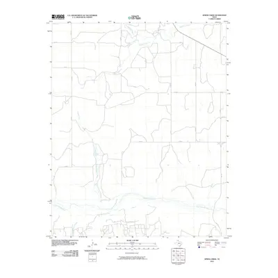
2010 Map of Spring Creek
USGS Topo · Published 2010About this map
The North Fork Red River creates a wide, braided path across the southern landscape of this Texas Panhandle survey, defining the local hydrology and drainage patterns. Flowing southward through Wheeler County, Spring Creek and Graham Creek feed toward this primary river system, carving modest depressions into the high plains. The landscape is predominantly divided by a grid of rural county roads, including Co RD I and Co RD K, which reflect the long-standing agricultural and ranching land divisions of the region.
Find a feature on this map
16 named features on this map. Tap any name to fly to it.
Don’t see what you’re looking for? This feature index may not catch every label — zoom into the map to look around manually.
Map Details
Editions of this 2010 Spring Creek Map
This is the sole edition of this map. No revisions or reprints were ever made.
Other maps of this area

1954 · Amarillo
USGS Topo · 1:250,000

1958 · Amarillo
USGS Topo · 1:250,000

1962 · Back
USGS Topo · 1:24,000

1962 · Pond Creek
USGS Topo · 1:24,000

1962 · Wheeler
USGS Topo · 1:24,000

1962 · Spring Creek
USGS Topo · 1:24,000

1962 · Wheeler SE
USGS Topo · 1:24,000

1962 · Pakan
USGS Topo · 1:24,000

1963 · Briscoe
USGS Topo · 1:24,000

1963 · Mobeetie
USGS Topo · 1:24,000