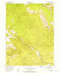
1950 Map of Spring Garden
USGS Topo · Published 1958About this map
Spring Garden and the Western Pacific railroad corridor serve as the primary human footprint in this mid-century survey of the northern Sierra Nevada. The terrain is dominated by the Plumas National Forest, including the State Game Refuge and the Feather River Experimental Forest (PNF). Evidence of historical extraction is present at the Johnson Mine (Abandoned) and scattered camps like Bradys Camp. The railroad follows the winding path of Greenhorn Creek and Estray Creek, negotiating the significant elevation changes of the Grizzly Ridge landscape. This 1950 field-checked map captures the region's transition into more formalized forestry and resource management, with infrastructure like the Fire Station at Lee Summit and small clearings such as Cutler Meadow and Fells Flat interspersed between the high peaks of Tower Rock and Taylor Rock.
Find a feature on this map
33 named features on this map. Tap any name to fly to it.
Don’t see what you’re looking for? This feature index may not catch every label — zoom into the map to look around manually.
Map Details
Editions of this 1950 Spring Garden Map
2 editions found
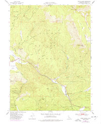
Other maps of this area

1886 · Honey Lake
USGS Topo · 1:250,000

1891 · Downieville
USGS Topo · 1:125,000

1891 · Honey Lake
USGS Topo · 1:250,000

1893 · Honey Lake
USGS Topo · 1:250,000

1893 · Downieville
USGS Topo · 1:125,000

1895 · Downieville
USGS Topo · 1:125,000

1896 · Downieville
USGS Topo · 1:125,000

1897 · Downieville
USGS Topo · 1:125,000

1937 · Blairsden
USGS Topo · 1:48,000

1943 · Blairsden
USGS Topo · 1:62,500