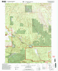
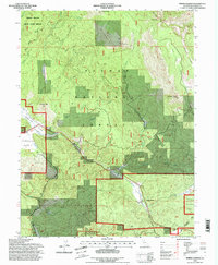
1994 Map of Spring Garden
USGS Topo · Published 1998About this map
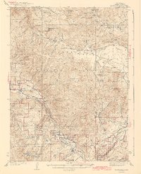
The high Sierra Nevada terrain of the Plumas National Forest dominates this 1990s revision, showing a landscape defined by steep drainages and isolated outposts. The small settlement of Spring Garden sits near the junction of the Feather River Hwy and Estray Creek, while further north, the high-altitude Bradys Camp is tucked beneath the massive spine of Grizzly Ridge. Industrial footprints are visible at the Johnson Mine and a nearby Quarry near Johnson Hill, reflecting the region's long history of resource extraction.
Find a feature on this map
49 named features on this map. Tap any name to fly to it.
Don’t see what you’re looking for? This feature index may not catch every label — zoom into the map to look around manually.
Map Details
Editions of this 1994 Spring Garden Map
2 editions found
Other maps of this area

1886 · Honey Lake
USGS Topo · 1:250,000

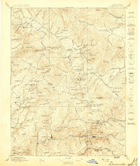
1891 · Downieville
USGS Topo · 1:125,000

1891 · Honey Lake
USGS Topo · 1:250,000

1893 · Honey Lake
USGS Topo · 1:250,000

1893 · Downieville
USGS Topo · 1:125,000

1895 · Downieville
USGS Topo · 1:125,000

1896 · Downieville
USGS Topo · 1:125,000
1897 · Downieville
USGS Topo · 1:125,000
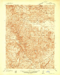
1937 · Blairsden
USGS Topo · 1:48,000
1943 · Blairsden
USGS Topo · 1:62,500