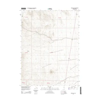
2015 Map of Spring Gulch
USGS Topo · Published 2015About this map
Goshute Mountains dominate the western portion of this high-desert landscape in Elko County, providing a stark topographical contrast to the broad valleys and drainage systems to the east. The terrain is defined by dramatic elevation shifts, anchored by Wildcat Peak in the southern reaches and the ridgelines of Lion Canyon further north. This 2015 survey illustrates a land where water sources are vital but sparse, as evidenced by named seasonal points like Choke Cherry Spring, Lone Choke Cherry Spring, and the namesake Spring Gulch. Human infrastructure is minimal, represented primarily by the north-south corridor of Alt 93 skirting the eastern edge of the mountains, while the land remains largely divided by its original Public Land Survey System townships and ranges, such as t31n r69e. Drainage patterns like Felt Wash and the depression of Morgan Basin reveal the natural flow of the watershed through this isolated Nevada range.
Find a feature on this map
16 named features on this map. Tap any name to fly to it.
Don’t see what you’re looking for? This feature index may not catch every label — zoom into the map to look around manually.
Map Details
Editions of this 2015 Spring Gulch Map
This is the sole edition of this map. No revisions or reprints were ever made.
Other maps of this area

1955 · Elko
USGS Topo · 1:250,000

1958 · Elko
USGS Topo · 1:250,000

1962 · Elko
USGS Topo · 1:250,000

1965 · Elko
USGS Topo · 1:250,000

1972 · Ferguson Flat
USGS Topo · 1:24,000

1972 · Morgan Pass
USGS Topo · 1:24,000

1972 · Lion Spring
USGS Topo · 1:24,000

1972 · Ferguson Mtn.
USGS Topo · 1:24,000

1972 · Ola
USGS Topo · 1:24,000
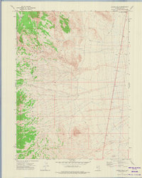
1972 · Spring Gulch
USGS Topo · 1:24,000