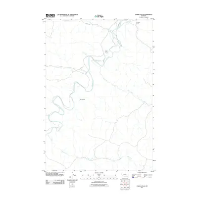
2011 Map of Spring Gulch
USGS Topo · Published 2011About this map
Tongue River meanders through this portion of Rosebud County, Montana, providing a lifeblood for the agricultural irrigation systems of the high plains. The landscape is defined by its drainage network, where names like Flying V Ditch, Four D Ditch, and FL Ditch indicate a history of water management for cattle ranching and farming. These man-made channels parallel the river, cutting across the valley floor to support the arid surrounding terrain.
Find a feature on this map
13 named features on this map. Tap any name to fly to it.
Don’t see what you’re looking for? This feature index may not catch every label — zoom into the map to look around manually.
Map Details
Editions of this 2011 Spring Gulch Map
This is the sole edition of this map. No revisions or reprints were ever made.
Other maps of this area

1954 · Hardin
USGS Topo · 1:250,000

1957 · Hardin
USGS Topo · 1:250,000

1958 · Hardin
USGS Topo · 1:250,000

1967 · Holmes Ranch
USGS Topo · 1:24,000

1967 · Birney
USGS Topo · 1:24,000

1967 · Tongue River Dam
USGS Topo · 1:24,000

1967 · Lacey Gulch
USGS Topo · 1:24,000
1967 · Pine Butte School
USGS Topo · 1:24,000
1967 · Spring Gulch
USGS Topo · 1:24,000
1967 · Taintor Desert
USGS Topo · 1:24,000