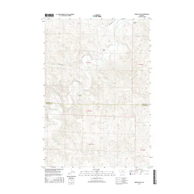
2017 Map of Spring Gulch
USGS Topo · Published 2017About this map
The Tongue River carves a winding path through this corner of Montana, defining the local geography across the Rosebud Co Big Horn Co border. This high-plains landscape is characterized by its drainage network, where the river is fed by tributaries like Canyon Cr and Harris Cr. Irrigation infrastructure is visible through the presence of the FL Ditch, reflecting the historical and ongoing management of water in this semi-arid environment.
Find a feature on this map
19 named features on this map. Tap any name to fly to it.
Don’t see what you’re looking for? This feature index may not catch every label — zoom into the map to look around manually.
Map Details
Editions of this 2017 Spring Gulch Map
This is the sole edition of this map. No revisions or reprints were ever made.
Other maps of this area

1954 · Hardin
USGS Topo · 1:250,000

1957 · Hardin
USGS Topo · 1:250,000

1958 · Hardin
USGS Topo · 1:250,000

1967 · Holmes Ranch
USGS Topo · 1:24,000

1967 · Birney
USGS Topo · 1:24,000

1967 · Tongue River Dam
USGS Topo · 1:24,000

1967 · Lacey Gulch
USGS Topo · 1:24,000
1967 · Pine Butte School
USGS Topo · 1:24,000
1967 · Spring Gulch
USGS Topo · 1:24,000
1967 · Taintor Desert
USGS Topo · 1:24,000