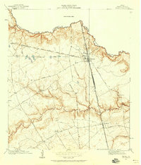
1916 Map of Spring
USGS Topo · Published 1958About this map
Spring stands at the intersection of early twentieth-century rail lines, serving as a primary hub for northern Harris County during this 1916 survey. The landscape is defined by the winding course of Spring Creek, which marks the northern boundary, and the lower Cypress Creek drainage system. A series of deep gullies, including Seals Gully, Senger Gully, and Lemm Gully, carve through the terrain between these major waterways.
Find a feature on this map
33 named features on this map. Tap any name to fly to it.
Don’t see what you’re looking for? This feature index may not catch every label — zoom into the map to look around manually.
Map Details
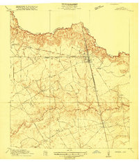
Editions of this 1916 Spring Map
3 editions found
Other maps of this area

1916 · Aldine
USGS Topo · 1:24,000

1916 · Louetta
USGS Topo · 1:24,000

1916 · Satsuma
USGS Topo · 1:24,000

1916 · Humble
USGS Topo · 1:24,000

1916 · Spring
USGS Topo · 1:24,000

1919 · Aldine
USGS Topo · 1:31,680

1919 · Humble
USGS Topo · 1:31,680

1919 · Weeden
USGS Topo · 1:31,680

1920 · Spring
USGS Topo · 1:31,680

1920 · Louetta
USGS Topo · 1:31,680