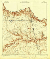
1920 Map of Spring
USGS Topo · Published 1942About this map
Spring Creek and its complex network of gullies define the northern border of Harris County on this survey, reflecting the landscape as it appeared just after the First World War. The rail crossroads at Spring serves as a focal point, where the International and Great Northern and its Fort Worth Line intersect. To the south, the Galveston Houston and Henderson railroad line passes through Westfield and Sellers, paralleling the watercourse of Cypress Creek. The rural character of the area is emphasized by a high density of small local institutions serving farming families, including Roth School, Rothman School, Shultz School, and Harril School. Early road networks like Stuebner Road and Louetta Road connect the scattered settlements of Rotherwood, Klein, and Bammel, showing the distribution of early 20th-century residential and agricultural activity before the region's suburban expansion.
Find a feature on this map
31 named features on this map. Tap any name to fly to it.
Don’t see what you’re looking for? This feature index may not catch every label — zoom into the map to look around manually.
Map Details
Editions of this 1920 Spring Map
2 editions found
Other maps of this area

1916 · Aldine
USGS Topo · 1:24,000

1916 · Louetta
USGS Topo · 1:24,000

1916 · Satsuma
USGS Topo · 1:24,000

1916 · Humble
USGS Topo · 1:24,000

1916 · Spring
USGS Topo · 1:24,000

1919 · Aldine
USGS Topo · 1:31,680

1919 · Humble
USGS Topo · 1:31,680

1919 · Weeden
USGS Topo · 1:31,680

1920 · Spring
USGS Topo · 1:31,680

1920 · Louetta
USGS Topo · 1:31,680