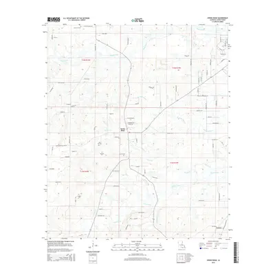
2015 Map of Spring Ridge
USGS Topo · Published 2015About this map
Spring Ridge sits at the heart of this landscape, where the upland ridges of Caddo Parish are defined by an intricate network of waterways including Boggy Bayou and Buchanan Bayou. This survey captures the rural character of the region as it appeared in the early 21st century, illustrating a transition from traditional land divisions into modern residential development. Family history researchers will find a significant concentration of burial sites, such as the Mount Olive Cem to the north and the Davidson Cem and Johnson Cem near the central settlement area.
Find a feature on this map
84 named features on this map. Tap any name to fly to it.
Don’t see what you’re looking for? This feature index may not catch every label — zoom into the map to look around manually.
Map Details
Editions of this 2015 Spring Ridge Map
This is the sole edition of this map. No revisions or reprints were ever made.
Other maps of this area

1943 · Waskom
USGS Topo · 1:62,500

1945 · Grand Cane
USGS Topo · 1:62,500

1945 · Waskom
USGS Topo · 1:62,500

1945 · Greenwood
USGS Topo · 1:62,500

1945 · Socagee Bayou
USGS Topo · 1:62,500

1955 · Shreveport
USGS Topo · 1:250,000
1955 · Shreveport West
USGS Topo · 1:24,000

1955 · Greenwood
USGS Topo · 1:62,500

1956 · Shreveport
USGS Topo · 1:250,000

1956 · Tyler
USGS Topo · 1:250,000