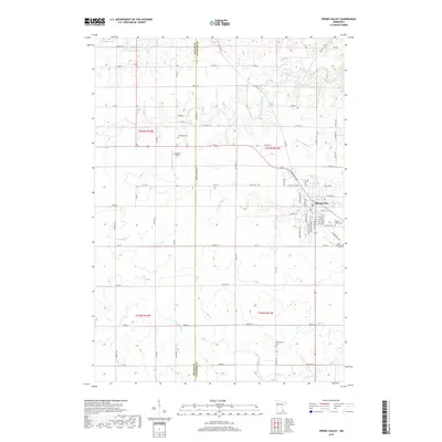
2019 Map of Spring Valley
USGS Topo · Published 2019About this map
Spring Valley occupies a prominent position in this southeastern Minnesota landscape, where the town plat sits at the junction of the Spring Valley Cr and several local transit corridors. The terrain is defined by the drainage systems of the S Br Root River and its tributaries, including Little Kingsley Cr and Bear Cr, which carve through the agricultural fields of both Fillmore and Mower counties.
Find a feature on this map
65 named features on this map. Tap any name to fly to it.
Don’t see what you’re looking for? This feature index may not catch every label — zoom into the map to look around manually.
Map Details
Editions of this 2019 Spring Valley Map
This is the sole edition of this map. No revisions or reprints were ever made.
Other maps of this area

1954 · Mason City
USGS Topo · 1:250,000
1955 · Stewartville
USGS Topo · 1:62,500
1955 · High Forest
USGS Topo · 1:62,500

1957 · Mason City
USGS Topo · 1:250,000

1958 · Mason City
USGS Topo · 1:250,000
1965 · Le Roy
USGS Topo · 1:24,000
1965 · Wykoff
USGS Topo · 1:24,000
1965 · Spring Valley
USGS Topo · 1:24,000
1965 · Grand Meadow
USGS Topo · 1:24,000
1965 · Ostrander
USGS Topo · 1:24,000