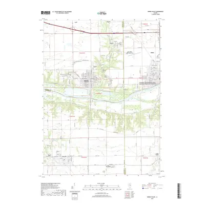
2018 Map of Spring Valley
USGS Topo · Published 2018About this map
The Illinois River serves as a central corridor for this 2018 survey, where the legacy of industrial transport is preserved in the Illinois and Michigan Canal National Heritage Corridor. This area is characterized by a high concentration of established settlements and sacred sites, with Spring Valley and Peru anchoring the northeastern corner of the map. The landscape is densely marked by local history, including numerous family and church cemeteries such as Miller Cem, Saint Valentines Cem, and the Lithuanian Cem near Dalzell.
Find a feature on this map
86 named features on this map. Tap any name to fly to it.
Don’t see what you’re looking for? This feature index may not catch every label — zoom into the map to look around manually.
Map Details
Editions of this 2018 Spring Valley Map
This is the sole edition of this map. No revisions or reprints were ever made.
Other maps of this area

1893 · Lacon
USGS Topo · 1:62,500

1893 · Hennepin
USGS Topo · 1:62,500

1893 · Lasalle
USGS Topo · 1:62,500

1909 · Hennepin
USGS Topo · 1:62,500

1911 · La Salle
USGS Topo · 1:62,500

1911 · Hennepin
USGS Topo · 1:62,500

1913 · La Salle
USGS Topo · 1:62,500

1933 · Lacon
USGS Topo · 1:62,500

1934 · Wenona
USGS Topo · 1:48,000

1937 · Lacon
USGS Topo · 1:62,500