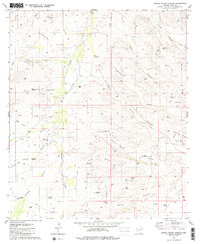
1981 Map of Spring Water Canyon
USGS Topo · Published 1981About this map
Cienega Creek winds through this desert landscape, serving as a vital corridor for the scattered ranching operations in the early 1980s. The map documents the critical water infrastructure required for cattle and homesteads in the arid Pima County terrain, featuring named outposts like Cienega Ranch, Hummel Ranch, and Clyne Ranch. A network of four-wheel-drive trails connects remote points of interest, including the Lower Spring Water Windmill and the Upper Spring Water Windmill. The drainage patterns are intricate, with Spring Water Canyon and Mud Spring Canyon cutting through the topography alongside numerous washes and gulches like Fortynine Wash and Oak Tree Gulch. This survey captures a moment when traditional land use persisted through remote windmills and tanks, such as Boulder Tank and the Cottonwood Windmill, essential for sustaining life and industry across these high desert reaches.
Find a feature on this map
48 named features on this map. Tap any name to fly to it.
Don’t see what you’re looking for? This feature index may not catch every label — zoom into the map to look around manually.
Map Details
Editions of this 1981 Spring Water Canyon Map
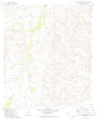
2 editions found
Other maps of this area

1904 · Patagonia
USGS Topo · 1:125,000

1905 · Patagonia
USGS Topo · 1:125,000

1915 · Benson
USGS Topo · 1:125,000

1926 · Whetstone
USGS Topo · 1:62,500

1932 · Elgin
USGS Topo · 1:62,500

1938 · Huachuca
USGS Topo · 1:62,500

1940 · Elgin
USGS Topo · 1:62,500

1943 · Benson
USGS Topo · 1:125,000

1947 · Elgin
USGS Topo · 1:62,500

1948 · Elgin
USGS Topo · 1:24,000