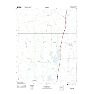
2012 Map of Springer
USGS Topo · Published 2012About this map
Springer and the surrounding Carter County countryside are defined by a complex network of creeks and localized industrial activity as it appeared in the early 21st century. The landscape is heavily dissected by waterways including Henry House Cr, Grindstone Cr, and the winding Caddo Cr. Local infrastructure supports both agriculture and the petroleum industry, evidenced by the presence of the Caddo Pool Oil Field and the Noble-Sea Cattle Company Reservoir.
Find a feature on this map
67 named features on this map. Tap any name to fly to it.
Don’t see what you’re looking for? This feature index may not catch every label — zoom into the map to look around manually.
Map Details
Editions of this 2012 Springer Map
This is the sole edition of this map. No revisions or reprints were ever made.
Other maps of this area

1901 · Ardmore
USGS Topo · 1:125,000

1918 · Ardmore
USGS Topo · 1:125,000

1957 · Ardmore
USGS Topo · 1:250,000

1963 · Ardmore
USGS Topo · 1:250,000

1964 · Ardmore East
USGS Topo · 1:24,000

1964 · Ardmore West
USGS Topo · 1:24,000
1964 · Gene Autry
USGS Topo · 1:24,000

1964 · Springer
USGS Topo · 1:24,000

1964 · Turner Falls
USGS Topo · 1:24,000
1965 · Dougherty
USGS Topo · 1:24,000