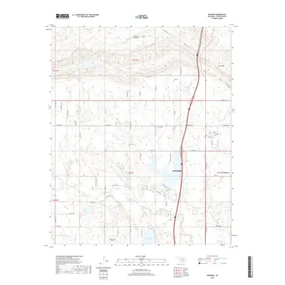
2018 Map of Springer
USGS Topo · Published 2018About this map
The northern reaches of Ardmore and the community of Springer meet at the foothills of the Arbuckle Mountains, where the landscape is defined by a network of creeks and rural family holdings. The terrain transitions from the rugged heights of the Arbuckles in the north, featuring Henry House Falls, down toward the fertile drainage basins of Caddo Cr and Grindstone Cr. This 2018 survey reveals a landscape where modern infrastructure, such as I-35, cuts through a historical geography established by local families and ranching interests.
Find a feature on this map
70 named features on this map. Tap any name to fly to it.
Don’t see what you’re looking for? This feature index may not catch every label — zoom into the map to look around manually.
Map Details
Editions of this 2018 Springer Map
This is the sole edition of this map. No revisions or reprints were ever made.
Other maps of this area

1901 · Ardmore
USGS Topo · 1:125,000

1918 · Ardmore
USGS Topo · 1:125,000

1957 · Ardmore
USGS Topo · 1:250,000

1963 · Ardmore
USGS Topo · 1:250,000

1964 · Ardmore East
USGS Topo · 1:24,000

1964 · Ardmore West
USGS Topo · 1:24,000
1964 · Gene Autry
USGS Topo · 1:24,000

1964 · Springer
USGS Topo · 1:24,000

1964 · Turner Falls
USGS Topo · 1:24,000
1965 · Dougherty
USGS Topo · 1:24,000