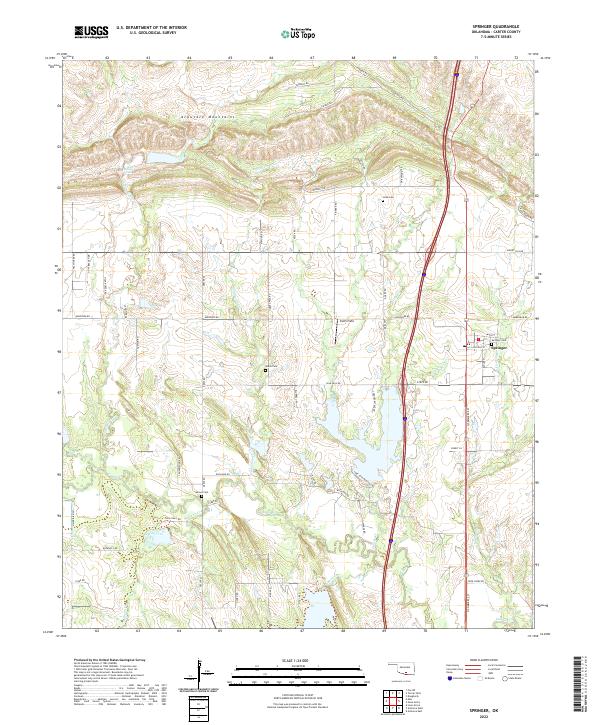
2022 Map of Springer
USGS Topo · Published 2022About this map
The Arbuckle Mountains dominate the northern landscape of this Carter County region, where the terrain transitions into a complex network of creeks and prairie. The settlement of Springer serves as a central hub, surrounded by a high density of family and community burial sites including Springer Cem, Gaines Cem, Glenn Cem, and Cobb Cem, which offer significant value for genealogical research in south-central Oklahoma. Water is a defining feature of the area, notably at Henry House Falls and along the winding courses of Grindstone Cr, Philips Cr, and Caddo Cr. The modern landscape is further defined by aviation and transportation infrastructure, such as Smith Field and a grid of rural roads like Hereford Rd and Blue Bell Rd that connect dispersed homesteads and agricultural tracts across the southern plains.
Find a feature on this map
68 named features on this map. Tap any name to fly to it.
Don’t see what you’re looking for? This feature index may not catch every label — zoom into the map to look around manually.
Map Details
Editions of this 2022 Springer Map
This is the sole edition of this map. No revisions or reprints were ever made.
Other maps of this area

1901 · Ardmore
USGS Topo · 1:125,000

1918 · Ardmore
USGS Topo · 1:125,000

1957 · Ardmore
USGS Topo · 1:250,000

1963 · Ardmore
USGS Topo · 1:250,000

1964 · Ardmore East
USGS Topo · 1:24,000

1964 · Ardmore West
USGS Topo · 1:24,000
1964 · Gene Autry
USGS Topo · 1:24,000

1964 · Springer
USGS Topo · 1:24,000

1964 · Turner Falls
USGS Topo · 1:24,000
1965 · Dougherty
USGS Topo · 1:24,000