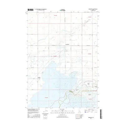
2017 Map of Springfield
USGS Topo · Published 2017About this map
Springfield and the nearby community of Sterling serve as the primary hubs in this agricultural landscape of southeastern Idaho. The area is defined by a sophisticated network of water management, with the Aberdeen Springfield Canal and the Low Line Canal cutting across the terrain to support local farming. The southern half of the map is dominated by the expansive American Falls Reservoir, which submerged the original riverbanks of the Snake River. The geography here transitions from the irrigation-dependent plains in the north to the sprawling wetlands of the Fort Hall Bottoms and the various branches of McTucker Creek in the south. This survey illustrates the intricate balance between industrial-scale irrigation and the natural river systems, highlighted by landmarks like McTucker Island and the rugged contours of the Snake River Valley.
Find a feature on this map
53 named features on this map. Tap any name to fly to it.
Don’t see what you’re looking for? This feature index may not catch every label — zoom into the map to look around manually.
Map Details
Editions of this 2017 Springfield Map
This is the sole edition of this map. No revisions or reprints were ever made.
Other maps of this area

1934 · American Falls
USGS Topo · 1:62,500

1934 · Michaud
USGS Topo · 1:62,500

1936 · American Falls
USGS Topo · 1:62,500

1937 · Michaud
USGS Topo · 1:62,500

1954 · Pocatello
USGS Topo · 1:250,000

1955 · Springfield NW
USGS Topo · 1:24,000

1955 · Rockford
USGS Topo · 1:24,000

1955 · Pingree
USGS Topo · 1:24,000

1955 · Springfield
USGS Topo · 1:24,000

1955 · Idaho Falls
USGS Topo · 1:250,000