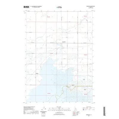
2020 Map of Springfield
USGS Topo · Published 2020About this map
The American Falls Reservoir dominates the southern landscape of this Bingham County region, where the Snake River feeds into a massive irrigation and power network. The settlements of Springfield and Sterling anchor a rural grid defined by the Aberdeen Springfield Canal and its various laterals, which turned this portion of the Snake River Valley into a productive agricultural zone. The map captures the complex hydrology of the area, including Danielson Creek and McTucker Creek, which meander through the marshy lowlands near the reservoir's edge.
Find a feature on this map
53 named features on this map. Tap any name to fly to it.
Don’t see what you’re looking for? This feature index may not catch every label — zoom into the map to look around manually.
Map Details
Editions of this 2020 Springfield Map
This is the sole edition of this map. No revisions or reprints were ever made.
Other maps of this area

1934 · American Falls
USGS Topo · 1:62,500

1934 · Michaud
USGS Topo · 1:62,500

1936 · American Falls
USGS Topo · 1:62,500

1937 · Michaud
USGS Topo · 1:62,500

1954 · Pocatello
USGS Topo · 1:250,000

1955 · Springfield NW
USGS Topo · 1:24,000

1955 · Rockford
USGS Topo · 1:24,000

1955 · Pingree
USGS Topo · 1:24,000

1955 · Springfield
USGS Topo · 1:24,000

1955 · Idaho Falls
USGS Topo · 1:250,000