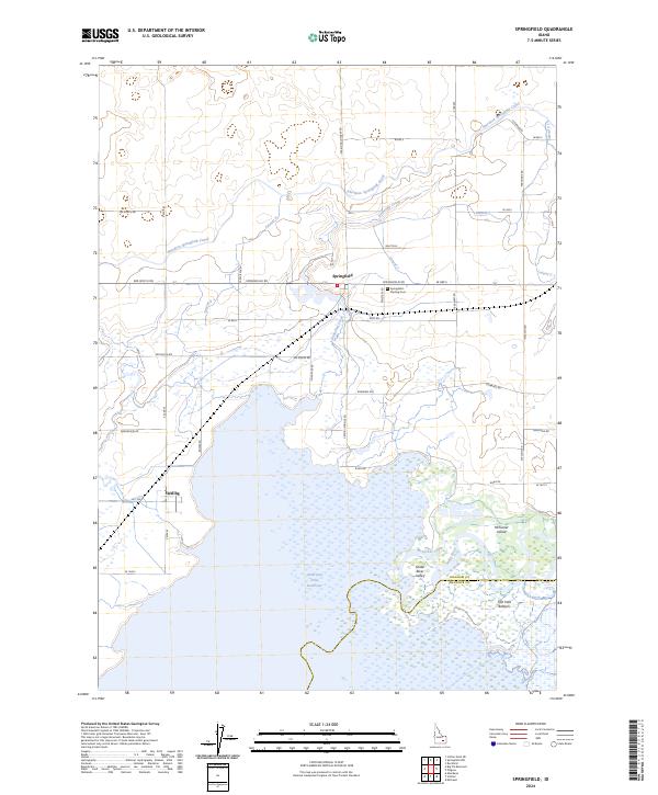
2024 Map of Springfield
USGS Topo · Published 2024About this map
Springfield and Sterling anchor this agricultural and aquatic landscape in Bingham County, where the high desert meets the northern reaches of the American Falls Reservoir. The region is defined by an intricate network of irrigation, most notably the Aberdeen Springfield Canal and its numerous laterals, which transform the arid terrain into productive farmland. To the south, the reservoir gives way to the wetlands and channels of the Snake River, creating a complex riparian environment that includes McTucker Island and the Fort Hall Bottoms.
Find a feature on this map
52 named features on this map. Tap any name to fly to it.
Don’t see what you’re looking for? This feature index may not catch every label — zoom into the map to look around manually.
Map Details
Editions of this 2024 Springfield Map
This is the sole edition of this map. No revisions or reprints were ever made.
Other maps of this area

1934 · American Falls
USGS Topo · 1:62,500

1934 · Michaud
USGS Topo · 1:62,500

1936 · American Falls
USGS Topo · 1:62,500

1937 · Michaud
USGS Topo · 1:62,500

1954 · Pocatello
USGS Topo · 1:250,000

1955 · Springfield NW
USGS Topo · 1:24,000

1955 · Rockford
USGS Topo · 1:24,000

1955 · Pingree
USGS Topo · 1:24,000

1955 · Springfield
USGS Topo · 1:24,000

1955 · Idaho Falls
USGS Topo · 1:250,000