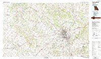
1982 Map of Springfield
USGS Topo · Published 1983About this map
Springfield anchor this region of southwest Missouri, showing a city in transition with established institutions like Southwest Missouri State University and major healthcare hubs including St John's Medical Center and Burge Medical Center. The landscape is defined by the James River and Little Sac River systems, which feed significant reservoirs such as Fellows Lake and McDaniel Lake. Beyond the urban core, the map detail extends to the Wilson's Creek National Battlefield and the University of Missouri Experimental Farm, illustrating the balance between historic preservation, agricultural research, and suburban expansion.
Find a feature on this map
145 named features on this map. Tap any name to fly to it.
Don’t see what you’re looking for? This feature index may not catch every label — zoom into the map to look around manually.
Map Details
Editions of this 1982 Springfield Map
This is the sole edition of this map. No revisions or reprints were ever made.
Other maps of this area

1884 · Springfield
USGS Topo · 1:125,000

1884 · Bolivar
USGS Topo · 1:125,000

1886 · Nevada
USGS Topo · 1:125,000

1886 · Stockton
USGS Topo · 1:125,000

1886 · Greenfield
USGS Topo · 1:125,000

1886 · Carthage
USGS Topo · 1:125,000

1886 · Springfield
USGS Topo · 1:125,000

1888 · Greenfield
USGS Topo · 1:125,000

1892 · Bolivar
USGS Topo · 1:125,000

1894 · Nevada
USGS Topo · 1:125,000