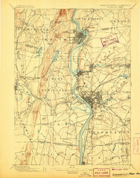
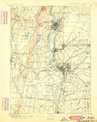
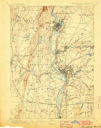
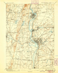
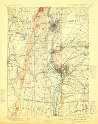
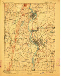
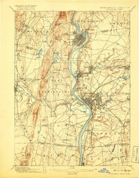
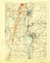
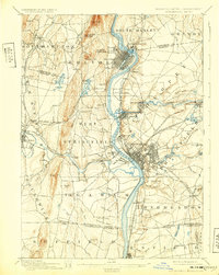
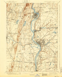
1895 Map of Springfield
USGS Topo · Published 1907About this map
The Connecticut River serves as the central artery of this late 19th-century industrial landscape, fueling the development of prominent manufacturing centers like Chicopee and the growing city of Springfield. The map reveals a complex industrial infrastructure where the Chicopee River powers settlements such as Chicopee Falls and Indian Orchard. To the north, the elevation of Mt Tom and Sheldon Hill contrasts with the dense urban grids of Holyoke and South Hadley Falls.
Find a feature on this map
98 named features on this map. Tap any name to fly to it.
Don’t see what you’re looking for? This feature index may not catch every label — zoom into the map to look around manually.
Map Details
Editions of this 1895 Springfield Map
11 editions found

1895 edition
15.8 x 19.9 inches
1900 edition
15.8 x 19.8 inches
1903 edition
15.8 x 19.9 inches
1905 edition
15.8 x 19.8 inches
1907 edition
15.7 x 20 inches
1909 edition
15.7 x 19.9 inches
1912 edition
15.8 x 19.8 inches
1917 edition
15.7 x 20.1 inches
1924 edition
15.8 x 19.8 inches
1932 edition
15.7 x 19.7 inches
1940 edition
15.8 x 19.7 inches
Historical Maps of Springfield Through Time
5 maps found


