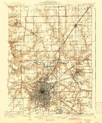
1907 Map of Springfield
USGS Topo · Published 1922About this map
The capital city of Springfield serves as the dense hub of this early 20th-century landscape, characterized by an intricate web of converging railroads. Major lines including the Chicago and Alton RR, Illinois Central RR, and the interurban Illinois Traction System facilitate the region's movement of coal and agricultural goods. Beyond the urban grid, the map highlights significant civic and military landmarks such as the State Fair Grounds, the historic Camp Lincoln training site, and the Reservoir. To the east, the Sangamon River meanders toward Riverton, while the rural periphery is dotted with smaller communities like Williamsville and Athens. The proximity of Calvary Cemetery and Camp Butler Cemetery offers valuable detail for genealogists researching families from the early statehood period through the post-Civil War era.
Find a feature on this map
63 named features on this map. Tap any name to fly to it.
Don’t see what you’re looking for? This feature index may not catch every label — zoom into the map to look around manually.
Map Details
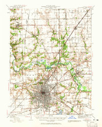
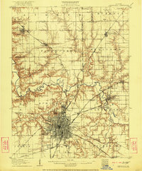
Editions of this 1907 Springfield Map
2 editions found

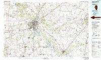
Historical Maps of Springfield Through Time
4 maps found