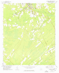
1978 Map of Springfield South
USGS Topo · Published 1978About this map
Springfield serves as a primary hub for this portion of Effingham County, characterized by a mix of municipal infrastructure and rural corridors. The presence of Effingham Academy and the County High Sch highlights the area's role as an educational center, while the Hospital and Radio Tower (WGEC) denote established community services in the late 1970s. The landscape is defined by the drainage systems of Ebenezer Creek and its many tributaries, such as Jacks Branch, which cut through the wooded terrain.
Find a feature on this map
30 named features on this map. Tap any name to fly to it.
Don’t see what you’re looking for? This feature index may not catch every label — zoom into the map to look around manually.
Map Details
Editions of this 1978 Springfield South Map
This is the sole edition of this map. No revisions or reprints were ever made.
Other maps of this area

1919 · Egypt
USGS Topo · 1:62,500

1920 · Hardeeville
USGS Topo · 1:62,500

1920 · Meldrim
USGS Topo · 1:62,500

1939 · Egypt
USGS Topo · 1:62,500

1942 · Meldrim
USGS Topo · 1:62,500

1942 · Savannah
USGS Topo · 1:62,500

1943 · Hardeeville
USGS Topo · 1:62,500

1943 · Egypt
USGS Topo · 1:62,500

1947 · Savannah
USGS Topo · 1:250,000

1948 · Savannah
USGS Topo · 1:250,000