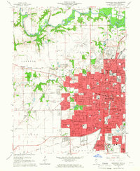
1965 Map of Springfield West
USGS Topo · Published 1966About this map
The State Capitol anchors the urban core of Springfield in the mid-1960s, a time when the city was expanding rapidly into Woodside Township. This survey shows a sophisticated transportation hub where the Capital Airport sits just north of a dense network of major railroads, including the Illinois Central and the Gulf Mobile and Ohio. Significant institutional and memorial sites are meticulously detailed, from Lincolns Tomb within Oak Ridge Cemetery to the sprawling Sacred Heart Academy and Concordia Seminary.
Find a feature on this map
114 named features on this map. Tap any name to fly to it.
Don’t see what you’re looking for? This feature index may not catch every label — zoom into the map to look around manually.
Map Details
Editions of this 1965 Springfield West Map
3 editions found
Other maps of this area

1907 · Springfield
USGS Topo · 1:62,500

1909 · Tallula
USGS Topo · 1:62,500

1922 · Divernon
USGS Topo · 1:62,500

1924 · Divernon
USGS Topo · 1:62,500

1924 · Waverly
USGS Topo · 1:62,500

1926 · Waverly
USGS Topo · 1:62,500

1930 · Springfield
USGS Topo · 1:62,500

1940 · Tallula
USGS Topo · 1:62,500

1940 · Springfield
USGS Topo · 1:62,500

1950 · Springfield West
USGS Topo · 1:24,000