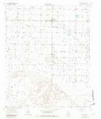
1962 Map of Springlake
USGS Topo · Published 1982About this map
Springlake serves as the primary hub of this Llano Estacado landscape, centered around a compact street grid and a cluster of agricultural structures. In the early 1960s, the surrounding terrain in Lamb County is defined by a rigorous pattern of groundwater extraction, with dozens of irrigation wells feeding the flat, productive acreage of the High Plains. The southern portion of the map reveals a shift in the land's character, where the orderly agricultural grid gives way to stabilized Sand dunes. This area is home to the small settlement of Roberson, providing a localized view of rural life on the Texas plains before modern expansion. Significant infrastructure of the era is evident in the straight lines of the Pipeline cutting across the territory and the presence of the Community Hall, which likely stood as a central gathering point for the farming families in this part of West Texas.
Find a feature on this map
7 named features on this map. Tap any name to fly to it.
Don’t see what you’re looking for? This feature index may not catch every label — zoom into the map to look around manually.
Map Details
Editions of this 1962 Springlake Map
2 editions found
Other maps of this area

1954 · Clovis
USGS Topo · 1:250,000

1958 · Clovis
USGS Topo · 1:250,000

1962 · Amherst
USGS Topo · 1:24,000

1962 · Cofferville
USGS Topo · 1:24,000

1962 · Springlake
USGS Topo · 1:24,000

1962 · Fieldton
USGS Topo · 1:24,000

1963 · Earth
USGS Topo · 1:24,000

1963 · Olton
USGS Topo · 1:24,000

1963 · Dodd SE
USGS Topo · 1:24,000

1963 · Dodd
USGS Topo · 1:24,000